Teton Reservior Survey - Passport in Time
Main menu:
PIT Highlights > Headlines > 2014
Teton Reservoir Stone Circles Recording & Survey Project
Rawlins Field Office (BLM), Wyoming, 2014
by Shelley Gregory, Rawlins Field Office
June 17, 2014
BLM Rawlins Surveys Archaeological Site with Passport in Time Volunteers
The Bureau of Land Management (BLM) Rawlins Field Office invited Passport in Time (PIT) volunteers from around the country to participate in the Teton Reservoir Stone Circles Recording and Survey Project, which began on June 16.
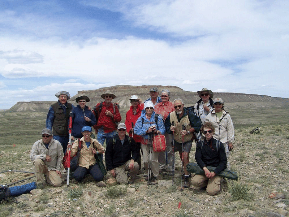
Passport in Time volunteers at the archaeological site with Sheep Mountain in the background. Left to right, back to front: Lloyd Rossa, Noreen Rossa, Gary VanderWeide, Katheryn Yauney, Ken Jans, Linda Jans, Steve Stephenson, Sally Stephenson, Dave Shinamura, Stacey Root, Dan Fisher, Sandy Tradlener, Larry Tradlener, Jasper McMurty.
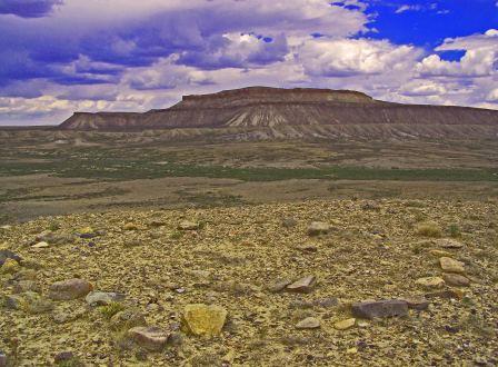
Sheep Mountain with one of the many stone circles in the foreground.
PIT volunteers are conducting a detailed recording of the stone circle site over two one-week sessions. According to Archaeologist Michael Oberndorf, “This is an important site. We want to see patterns within it and to understand its relationship to other sites along Little Sage Creek and in this part of the Kindt Basin." On the fifth day of each session, the volunteers will do a pedestrian survey along Little Sage Creek, which runs below the site and was dammed to create Teton Reservoir.
Oberndorf explains, “We are making a map of the entire site using a high-tech total station computerized mapping transit and making detailed scale drawings of the circles themselves.” The original recording of the archaeological site was done in 1974 with a cursory overview and a simple sketch map of 22 stone circles. Erosion by wind and water has exposed at least eight more circles and other features not shown in the original sketch.
The stone circle site is located about 15 miles south of Rawlins, Wyo., in the historically rich Kindt Basin. It is on a small ridge overlooking Teton Reservoir and Little Sage Creek with Sheep Mountain to the north, the Overland Trail a mile-and-a-half to the south, the Continental Divide Hiking Trail a mile to the west and the road across Bridger Pass about a mile to the northwest. The Cherokee Trail, created in 1849 by Cherokee gold rushers from Oklahoma also runs through the Kindt Basin, though its exact route is unknown and awaiting a PIT project to locate it.
Twenty-two volunteers for the Teton Reservoir project hail from Arizona, California, Colorado, Iowa, New Jersey, New Mexico, North Dakota, Ohio, Utah, Virginia, Washington and Wyoming. The PIT program teams up volunteers with professional archaeologists and historians on public lands throughout the U.S. to work on a wide range of archaeological and historic preservation projects. PIT was established nationally in 1991 and its honor roll includes 526 volunteers who have contributed 500 or more hours. There is no fee to participate but volunteers take care of their travel, accommodations, board and other expenses.